Are More Arizonans Living in a Floodplain?
By Linda Potter, chair of the Arizona Floodplain Management Association Programs & Policies Committee
reprinted with permission
Recent articles have been published about population growth within floodplains. One web site, governing.com,
used FEMA’s National Flood Hazard Layer and census tract population estimates to analyze the growth of population versus the growth of population with mapped floodplains.
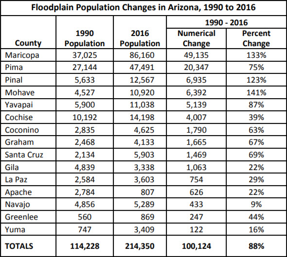
The information for Arizona has been extracted from the study’s database. It illustrates the changes in floodplain population between 1990 and 2016. Based upon this study, in 2016, more than 200,000 Arizonans live within FEMA identified 100-year floodplains.
Note that the study does not account for the increase in the identification of new floodplains. For example, between 1990 and 2016, Maricopa County has significantly increased the amount of regulatory floodplains, per Tim Murphy of the Flood Control District of Maricopa County. This could account for at least some of the population growth.
However, since NFIP (National Flood Insurance Program) and FEMA policies allow for development within floodplains, and the cost of flood insurance remains relatively low, people will likely continue to develop and move into flood-prone properties.